Anchors Away at the End of the World

We spent Christmas in Marco Island, Smoke House Bay. Trevor, our neighbor cruiser on White Pearl, joined us for a little Christmas Eve cheer. Later, we continued south to Goodland. The only businesses in Goodland are a marina and 5 restaurants. There is no place in this town to buy milk or bread, but if you want to drink beer and do the Buzzard Lope at Stan’s Idle Time bar, you are in like flint.
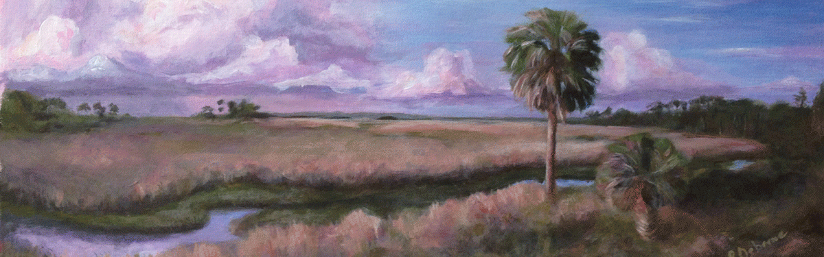
The painting of the green sailboat is from Goodland. This boat dragged on its anchor and ended up on the other side of our boat. We have no idea how it could have moved past us without bumping into Nice Lady. Must be the magnetic vortex.
Dec 26 – Dec 31, Goodland, FL
We stayed in this location for about a week. Great out of the way spot with services not too far away (3 miles in Marco Island). Local marina is not cruiser friendly, so there was no dinghy access to shore except at the city park.

GoodLand Sunset
Jan 1st, New Years Day – moved to Hog Key

Hog Key
We stayed here one night. Anchor held well. It felt good to be on the move again.
Jan 2nd – Lv Hog Key to Russell Pass close to Everglade City
We pulled up anchor and sailed across the bay to the beach at Panther Key. We took the dinghy ashore flipped it and scraped off the barnacles. Returned to the boat cooked breakfast. Then decided to move on to the next anchorage. The Gulf water was flat with a slight cool breeze and NO CRAB POTS! A perfect relaxing day on the water.
The islands are pretty and a few have sandy beaches. People kayak out to these islands and camp on the beach and fish. If you like remote deserted islands this is for you.
Our passage was pleasant and we anchored in Russell Pass about 5 miles outside of Everglade City, home of the Rod and Gun Club. No SeeUms sent us indoors early.
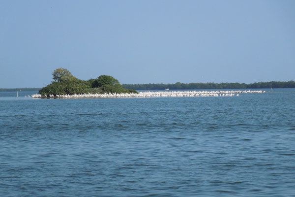
White Pelicans
Jan 3rd – Everglade City
We dinghied into Everglade City for fuel and water. We navigated our way thru the 10,000 islands with an app on my phone. Many spots were too shallow to cross. We finally made it out into the channel and continued our trek. We found a fuel dock at an exclusive gated RV park. Each RV site had pavers and was landscaped. We filled our gas and water tanks and cruised back down river. We stopped at the Rod and Gun Club for an early lunch. The seawall does not accommodate small boats. There was another boat there. The captain of the boat, Jim, offered that we could tie off to his boat and crawl over to the seawall. Very nice gesture. He is a merchant marine and on his way to the Dry Tortugas to snorkel. His boat is made by the same folks that made ours except his boat is a very low slung trimaran.
The Rod and Gun Club is an old historic building. The food and service were excellent. President Truman had a private lunch here the day he dedicated the Everglades National Park. These photos are still on Luke’s phone… Argh!
Jan 4th – Russell Pass to Shark River
Anchors Away… 4:30a a small storm blew through causing our anchor to start dragging. Our boat was heading down river at about 3 knots. YIKES! Luke woke me up this is an EMERGENCY! We are in the mangrove swamps and could run aground on oyster beds, run into the trees, or worse.
In the pitch black, Luke started the engine, pulled up the anchor and I was on the front deck in the rain with a spot light. I was trying to guide us out of the mangroves, but Luke kept turning into the swamp since the Garmin Chartplotter was indicating something different from what I was seeing. We must be in some magnetic vortex that is confusing our equipment. To communicate to Luke I had to go from the front of the boat to the rear to give instructions (in the dark and stormy rain and wind). He continued to turn towards the swamp. The current was fast and the boat was difficult to control. Luke could not see anything from the helm and was dependent on me for guidance, but was not listening well. 🙂

Wrapped in Foulies for Storm
After about 30 minutes of this type of blind navigation and fighting rain, wind, current, and magnetic vortex, we made it out into a marked channel. The Gulf was probably another mile out from our current location. We continued down the channel towards the Gulf always aware that we could be heading into very rough seas and bad weather. We kept an eye on the weather radar monitoring an approaching storm.
Once out in the Gulf, the waves were not too high but there are approaching storms. With no moon or stars to light our way we are concerned about the ever pre

Approaching Storms passed around us
sent millions of Crab Pots which could damage our prop leaving us stranded! We continued motoring south while monitoring the incoming storms. The radar indicated that the worst part of the storms should pass north of us. Fortunately, this was the case. Phew!
6:30am we began seeing the light from the sun peaking over the horizon. Most anticipated and welcomed sunrise of my life! Oh No Mr Bill! Wait, Luke finds something that he must do that requires hanging off of the stern of the boat. Lordy! The plug in the dinghy needed to be pulled out. The dinghy was filing with rain water. This can cause problems with weight on the back end of the boat and problems if we have higher winds and following seas.
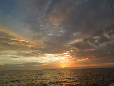
Amazing Grace Sunrise!
At this point in my day, I have not had any coffee or gone potty. I need a break from all of this morning joy. I rested for a bit and had some cold coffee. The rest of the passage was routine, arriving at our Shark River anchorage at 1:30pm.
Shark River is amazing. It is located just north of Cape Sable at the bottom of Florida in the Everglades National Park. It is at the end of the world, absolutely isolated and beautiful. In just a few hours I saw many birds, a few shark, a ray leap out of the water, dolphins and a manatee. Perfect end to an exciting day.

Shark River Sunset
That evening I was unable to get to sleep, Luke is peaceful snoring away. I was concerned about the anchor holding through the night due to the swift current. I attempted to sleep in the salon with one eye on the chartplotter which shows the distance from where we dropped the anchor.
The ChartPlotter is a GPS used similar to the one in your car. When we put down an anchor we mark that spot in the chart. Luke keeps track of how much chain (anchor rode) he lets out (scope). You should put out 7 feet of rode out for each foot of depth. As the evening goes by you can watch the ChartPlotter track the path of the boat the moves with the wind/current/tide. This should correspond to the amount of scope you have. If this changes the anchor could be dragging. The boat made several complete circles around the anchor which I had not seen before. WELL… about 1am the Chartplotter showed that we were moving. I woke up Luke. We monitored the system and our location. The boat stopped moving so it appeared the anchor was holding again. Where are my tranquilizers? Not much sleep…
To be continued.

Love these! Keep them coming! ⛵️
Sent from my iPad
>
LikeLike